Laser Scanning & Geospatial Services
High-Precision 3D Reality Capture
3D Reality Capture for Smarter, Safer, and Faster Construction
At CHAC United, we harness the power of advanced 3D laser scanning and geospatial technologies to deliver highly accurate, real-world data that supports better design, seamless construction, and efficient facility management. Our services help reduce errors, prevent rework, and accelerate decision-making across the project lifecycle — from concept to completion.
Leveraging LiDAR, GNSS, and photogrammetry, we produce intelligent, millimeter-accurate outputs – transforming real-world environments into digital assets with unmatched precision.
Our Core Capabilities Include
We leverage advanced technology to deliver accurate, real-world spatial data that enhances project planning, execution, and lifecycle management. Our comprehensive geospatial service suite empowers clients with high-precision insights across every project phase:

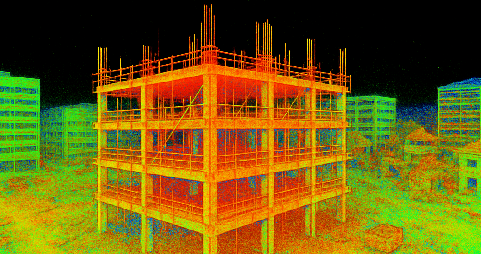
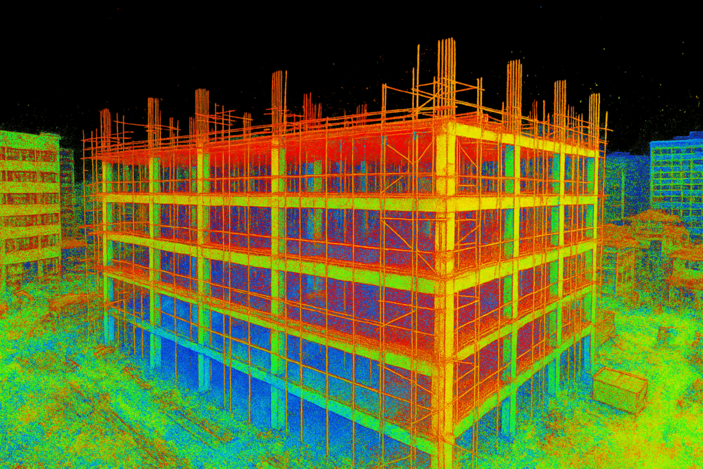
3D Laser Scanning / LiDAR Scanning
Capture millions of data points per second to generate high-resolution point clouds of buildings, industrial sites, and infrastructure — ideal for as-built validation and design planning.

Topographic & Boundary Surveys
We provide detailed elevation, contour, and property boundary data for planning, design, and regulatory approvals using GNSS/GPS and total station technology.

As-Built Documentation & Scan-to-BIM
Turn real-world conditions into intelligent BIM models. We create accurate 3D representations of existing structures for renovation, retrofit, and facility documentation.

Point Cloud Processing & 3D Modeling
We convert raw point cloud data into precise 2D drawings, 3D models, and CAD deliverables compatible with tools like Revit, AutoCAD, Navisworks, and Tekla.

Geospatial Mapping & Site Analysis
From terrain analysis and utility mapping to corridor and route alignment — we offer spatial intelligence for smarter infrastructure and urban development.

Drone Mapping & Aerial Photogrammetry
Using drones equipped with high-res cameras and GPS, we deliver orthophotos, 3D terrain models, and volumetric analysis for large-scale land and construction sites.
Let’s Transform Your Site Into a Digital Twin
Whether you’re capturing a single building or an entire infrastructure corridor, CHAC United delivers precision-driven geospatial insights.
Why Choose CHAC for Laser Scanning & Geospatial Services?
we combine advanced technology with deep industry expertise to deliver laser scanning and geospatial solutions that drive project success. Here’s why we’re a trusted partner across industries:
We utilize industry-leading LiDAR equipment and high-definition 3D scanners to capture spatial data with sub-millimeter precision - enabling accurate models, reducing rework, and supporting high-stakes decision-making.
Our skilled professionals bring years of hands-on experience in surveying, construction, and BIM modeling, ensuring data integrity and technical excellence at every stage of your project.
We deliver outputs fully compatible with platforms like AutoCAD, Revit, Tekla, Navisworks, Civil 3D, and ArchiCAD — making it easy for your teams to incorporate field-verified data into design, planning, and fabrication.
We follow strict data handling protocols to protect your project files, intellectual property, and privacy - ensuring your information stays secure from start to finish.
Request a Free Estimate
Whether you’re in the planning phase or ready to begin, we provide transparent, no-obligation estimates for all types of structural and detailing work.
- Expert structural & detailing solutions
- Global delivery (India, USA, Canada)
- BIM & Tekla-enabled workflows
- Fabrication-ready, code-compliant output
- Fast, clear communication
- Competitive & flexible pricing